
Destination and travel theme
Chile | Carretera Austral Road-trip from Puerto Montt to Caleta Tortel
The Carretera Austral is one of South America's strongest road-trip routes: ferry-linked fjords, temperate rainforest, glacier valleys, hanging bridges, marble caves and long stretches where offline maps matter more than a packed checklist. This guide is built for travelers who want the northern and central route without rushing all the way to Villa O'Higgins.
The lead quality is high. It combines recent 2025-2026 source signals: Chile Travel's official 2025 planning note, current traveler discussion about rental-car choice in high season, 2026 activity pricing for Marble Caves, and current route checks from Tourants Maps. It is also a good fit for LBS because each day has clear overnight bases and side-trip clusters.

Recommended duration
Best fit: 8 days / 7 nights
- Fast version: 6 days from Puerto Montt to Coyhaique, skipping Tortel
- Balanced version: 8 days to include Pumalin, Queulat, Marble Caves and Tortel
- Slow version: 12-14 days if continuing south to Villa O'Higgins or adding glacier hikes
Budget range
Plan USD 1,350-2,250 per person for 8 days, excluding international flights, based on two travelers sharing a compact SUV or high-clearance 2WD and mid-range lodging.
| Item | Practical range |
|---|---|
| Rental car | USD 55-110 per day, more for automatic, one-way or SUV |
| Fuel | USD 220-360 total for this route segment |
| Ferries | Keep a separate buffer; fares and schedules change by route and season |
| Lodging | USD 70-150 per room per night |
| Food | USD 30-55 per person per day |
| Marble Caves | Boat/kayak options often sit around USD 40-160 depending on format |
This is not a cheap road-trip once ferries, insurance and remote lodging are included. The value is flexibility: you can stop for weather windows, viewpoints, short hikes and small settlements that buses often miss.

Route overview
Puerto Montt -> Hornopiren -> Chaiten -> Puyuhuapi -> Coyhaique -> Puerto Rio Tranquilo -> Cochrane -> Caleta Tortel -> Coyhaique
Tourants Maps checks:
- Puerto Montt to Hornopiren: 106 km / about 2 hr 36 min
- Hornopiren to Chaiten: 135 km / about 5 hr 22 min, including the ferry-linked section
- Chaiten to Puyuhuapi: 188 km / about 2 hr 43 min
- Puyuhuapi to Coyhaique: 234 km / about 3 hr 54 min
- Coyhaique to Puerto Rio Tranquilo: 214 km / about 3 hr 48 min
- Puerto Rio Tranquilo to Cochrane: 114 km / about 2 hr 23 min
- Cochrane to Caleta Tortel: 125 km / about 2 hr 35 min
Treat these as planning baselines, not promises. Gravel, roadworks, ferry timing, rain and photo stops can change the real day by one to three hours.

Day-by-day plan
Day 1: Puerto Montt to Hornopiren
Pick up the car early in Puerto Montt, check the spare tire, confirm ferry documentation, then drive south to Hornopiren. This first day is mostly about logistics: buying snacks, learning the rental car, and avoiding a late arrival before the ferry section.
Do not book a tiny city car just because it is cheapest. Recent traveler discussion around high-season rentals focuses on whether low-clearance city cars are enough; for this route, a high-clearance 2WD or compact SUV is a better editorial recommendation.

Day 2: Hornopiren to Chaiten
This is the first big Carretera Austral day because ferry timing controls the rhythm. Reserve ferry space where required, arrive early, and avoid scheduling a paid excursion on arrival in Chaiten.
If the weather is clear, use Chaiten as a base for nearby Pumalin National Park viewpoints or short rainforest walks. Keep the day simple: missed ferries are more expensive than a shorter sightseeing list.
Day 3: Chaiten to Puyuhuapi
Drive south through forested sections and river valleys toward Puyuhuapi. This is a good day for slower stops, photos and a hot-springs evening if the schedule works.
Road surfaces can shift between pavement, gravel and potholes. After heavy rain, leave more braking distance and avoid trying to match Google Maps' fastest time.

Day 4: Puyuhuapi, Queulat and Coyhaique
Start early for Queulat National Park and the hanging glacier area. After the park, continue to Coyhaique, the route's practical reset point for fuel, groceries, laundry and repairs.
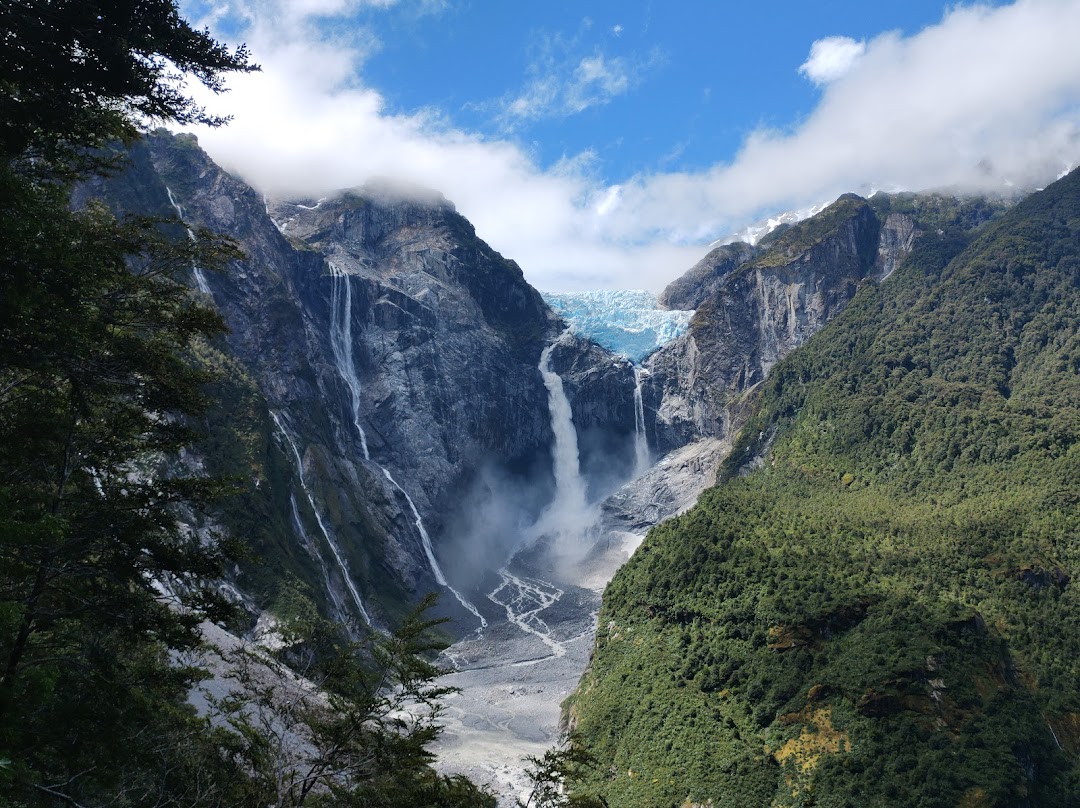
Coyhaique is worth treating as a logistics hub, not just a sleep stop. Fill the tank, restock water, and re-check the Marble Caves plan before driving toward Lago General Carrera.

Day 5: Coyhaique to Puerto Rio Tranquilo
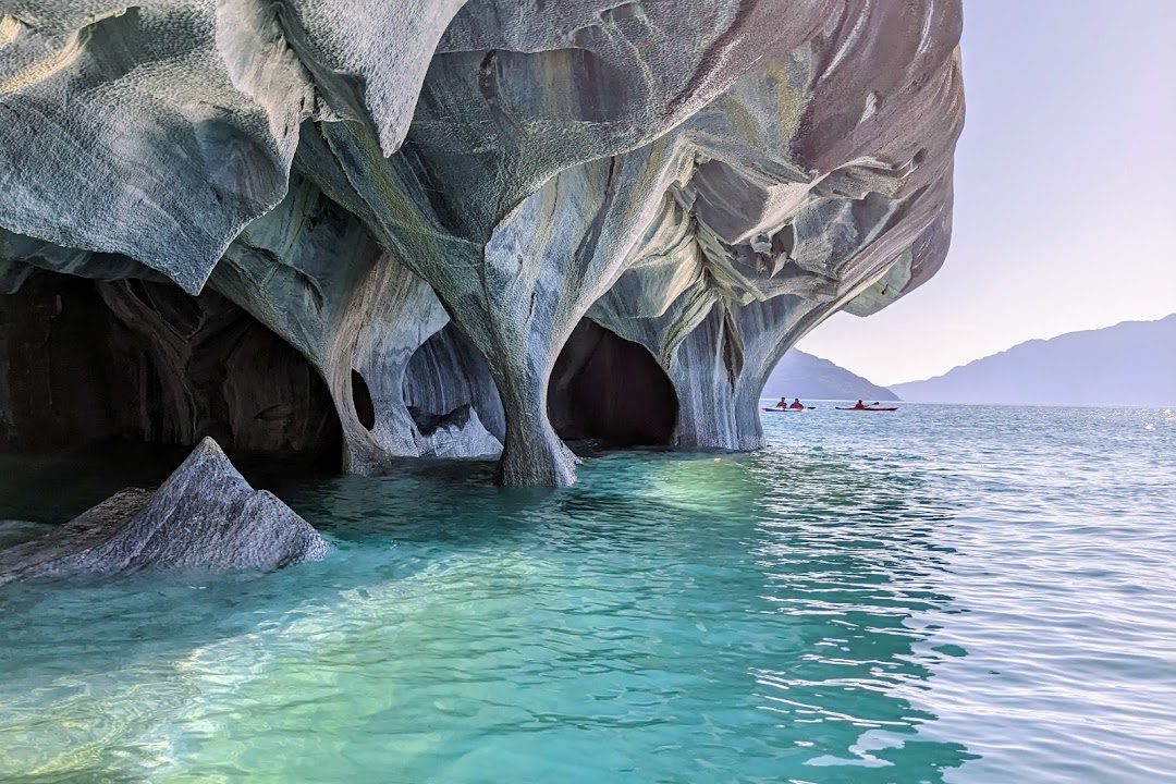
Drive toward Cerro Castillo scenery and continue to Puerto Rio Tranquilo on Lago General Carrera. If the lake is calm, book a Marble Caves boat or kayak trip; if wind is high, push the caves to the next morning.
GetYourGuide's 2026 listings show several current options, including 3-hour kayak tours from about USD 86 and shorter boat-style formats from about USD 65. Local pricing can be lower or higher depending on season, group size and language, so quote a range rather than one fixed fare.
Day 6: Puerto Rio Tranquilo to Cochrane
Use the morning as a weather backup for the Marble Caves, then drive south to Cochrane. This section starts to feel more remote, with fewer convenient services and longer quiet stretches.
Download offline maps before leaving Puerto Rio Tranquilo. Keep fuel conservative and do not skip open gas stations late in the day.

Day 7: Cochrane to Caleta Tortel
Drive to Caleta Tortel, a boardwalk village that works well as the route's atmospheric southern anchor without committing to the much longer Villa O'Higgins extension. Walk the wooden paths, stay quiet in residential areas, and avoid drone use near homes or docks.
If weather or road conditions look unstable, make Tortel optional and spend the night near Cochrane instead. The route is strongest when it stays flexible.
Day 8: Return toward Coyhaique
Return north with a wide buffer. Many travelers underestimate how tiring repeated gravel, ferries and remote services become by the end of the trip.
If flights are involved, do not plan this return on the same day as departure. A safer plan is to overnight in Coyhaique or Balmaceda before flying.
Why renting a car matters
The Carretera Austral can be done by bus and hitchhiking, but it is much stronger as a road-trip because a car lets travelers:
- Align Marble Caves, Queulat and short hikes with weather windows
- Carry food, rain layers and spare warm clothing
- Stop at fjords, bridges and small towns without tour timing
- Adjust when ferry schedules, roadworks or rain slow the route
- Build LBS-friendly clusters around Chaiten, Puyuhuapi, Coyhaique and Puerto Rio Tranquilo
Choose high clearance over a luxury category. Manual transmission is common and cheaper; automatic cars may be limited and more expensive.
Driving and safety notes
- Book or confirm ferry segments before committing to non-refundable lodging.
- Keep cash and a physical card; remote card terminals can fail.
- Download offline maps and save lodging phone numbers.
- Check tire condition, jack, reflective vest and emergency triangle at pickup.
- Do not drive fast on gravel after rain.
- Refuel whenever the next section looks remote.
- Ask the rental company in writing about gravel-road coverage and ferry rules.
- Keep a full day of flexibility if continuing south of Cochrane.
Best season
December to March is the easiest window for this version: longer days, more services and better ferry availability. November and April can be rewarding but require more conservative planning. Winter is not the target season for this guide because daylight, snow, rain and service closures change the risk profile.
Local customs and low-impact travel
- Respect small settlements as residential places, not photo sets.
- Stay on marked paths in parks and private-access areas.
- Avoid blocking narrow roads, ferry lanes and local driveways.
- Pack out trash; remote bins are limited.
- Buy groceries and fuel locally where possible.
- Ask before photographing people, working farms or private docks.
- Keep noise down in Caleta Tortel and other small overnight stops.
Visa and entry notes
Many travelers can enter Chile visa-free for tourism, but rules depend on nationality and can change. Travelers should verify current entry conditions before booking and make sure the rental contract permits the intended route, ferry crossings and any border detours.
Quality check
Lead quality: High
Why it passes: the topic is timely, route-based, easy to map, strong for road-trip content, and less duplicated in the current CMS than New Zealand South Island. It has practical verification from current traveler reports, official Chile tourism guidance, current activity pricing and Tourants Maps route checks.
Checked sources:
- Chile Travel official 2025 Carretera Austral planning article
- Lonely Planet guidance on getting around Chile and rental-car realities
- Tripadvisor 2025 traveler thread on Carretera Austral high-season rental-car choice
- GetYourGuide 2026 Puerto Rio Tranquilo / Marble Caves tour listings
- Worldly Adventurer 2026 Carretera Austral guide for route length and weather/road context
- Tourants Maps distance checks for the main daily route legs
- Unsplash semantic image search for Carretera Austral / Chile Patagonia road-trip cover imagery


Travel Tips
No tips yet. Be the first to share!