
Destination & Travel Theme
Faroe Islands | Torshavn, Vagar, Streymoy, Eysturoy and Northern Islands Road-trip
This 6-day Faroe Islands Road-trip is built for travelers who want dramatic North Atlantic scenery without turning the islands into a rushed photo checklist. The route uses Torshavn as the practical base, then links Vagar, Streymoy, Eysturoy, Gjogv and Klaksvik through bridges, ferries and subsea tunnels.
The lead is timely because the Faroe Islands have been actively nudging visitors beyond the same few crowded viewpoints. Recent overseas coverage highlighted the local self-navigating road-trip concept, where drivers are sent toward quieter stops instead of only the obvious icons. This guide keeps the classic sights, but spaces them out and adds practical tunnel, hike-fee, weather and route-planning advice.
Recommended Duration
Best fit: 6 days / 5 nights
- Fast version: 4 days for Vagar, Torshavn, Saksun and Gjogv only
- Balanced version: 6 days with weather buffers and one Northern Islands day
- Slower version: 8-9 days if adding Mykines, Suduroy or guided hikes
Budget Range
Expect DKK 9,500-15,500 per person for 6 days, excluding international flights, assuming two travelers share a compact rental car and mid-range lodging.
| Item | Practical range |
|---|---|
| Rental car | DKK 600-1,100 per day depending on season, insurance and transmission |
| Fuel | DKK 600-1,000 total for the core route |
| Accommodation | DKK 900-1,700 per room per night |
| Food | DKK 350-650 per person per day |
| Toll tunnels | Common rental add-on; check the rental contract carefully |
| Hike access fees | Tralanipa / Lake Above the Ocean is listed at DKK 200 per adult for unguided hiking |
This is not a cheap road-trip. The value is in rare scenery, short drives and high flexibility, not low daily spend.
Route Overview
Vagar Airport -> Gasadalur -> Sorvagsvatn / Tralanipa -> Torshavn -> Kirkjubour -> Saksun -> Tjornuvik -> Gjogv -> Eysturoy -> Klaksvik -> Torshavn
Tourants Maps checks put Vagar Airport to Torshavn at about 46.5 km / 44 min, Torshavn to Saksun at about 46 km / 48 min, Torshavn to Gjogv at about 47.6 km / 53 min, and Torshavn to Klaksvik at about 40.9 km / 45 min in normal conditions. The distances look short, but fog, wind, one-lane village roads and photo stops make the days feel bigger.
Keep the car small, keep plans flexible, and avoid loading every iconic viewpoint into one day.
Day-by-Day Itinerary
Day 1: Vagar Arrival, Gasadalur and Lake Above the Ocean
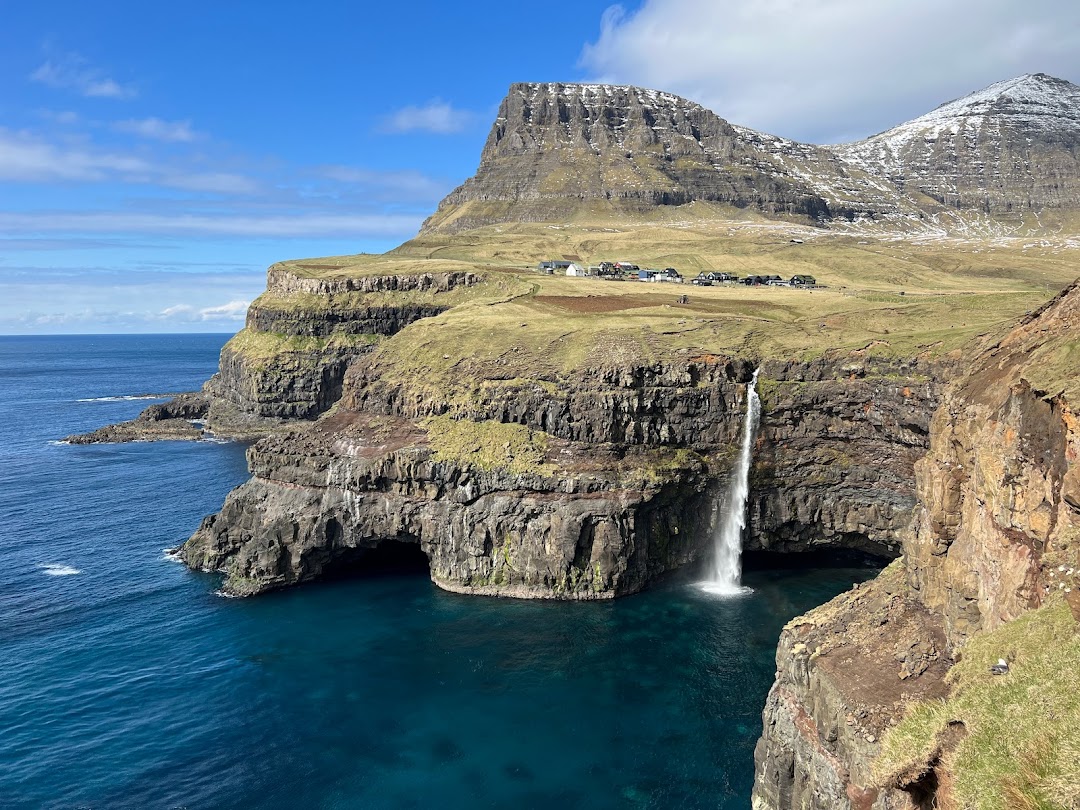
Pick up the car at Vagar Airport and stay on Vagar for the first day. Start with Gasadalur and Mullafossur Waterfall if visibility is good. Then choose the Sorvagsvatn / Tralanipa hike for the famous "lake above the ocean" perspective.
Keep this day light. Many visitors land, rush to every Vagar viewpoint, then drive tired through tunnels to Torshavn. A slower first day is safer and better for photography.
Practical notes:
- Check whether your rental company bills subsea tunnels individually or offers a tunnel pass.
- The Tralanipa hike crosses private land and has an access fee.
- Do not walk close to cliff edges in wind; gusts can arrive without warning.

Day 2: Torshavn, Kirkjubour and Local Food
Drive to Torshavn and use it as the trip's practical base. Walk Tinganes, the harbor area and the old turf-roof lanes, then make a short afternoon drive to Kirkjubour for coastal history and views.
This is the best day to stock up on groceries, confirm ferry schedules if extending to Suduroy, and leave space for a proper dinner. Torshavn is small, but it is the easiest place to recover from weather delays and expensive restaurant surprises.

Day 3: Saksun, Tjornuvik and Northern Streymoy
Drive north from Torshavn to Saksun and Tjornuvik. The scenery is big, but the roads are narrow and village parking is limited, so move slowly and avoid blocking local access.
Suggested pacing:
- Morning: Saksun valley and lagoon viewpoint
- Midday: picnic or cafe stop if open
- Afternoon: Tjornuvik beach and Risin og Kellingin sea-stack views
- Evening: return to Torshavn before dark or heavy fog
Do not treat private fields as photo sets. Stay on marked paths and respect signs, even if other visitors ignore them.


Day 4: Eysturoy, Gjogv and the Mountain Roads
Use the Eysturoy tunnel or the older road route depending on toll cost, weather and where you slept. Drive toward Gjogv, one of the strongest village stops in the connected islands. If the weather is clear, add a short viewpoint walk around Eidi or the Funningur area.
Gjogv is popular for a reason, but it is still a lived-in village. Park only where allowed, keep drone use conservative, and do not linger in front of private homes.

Day 5: Klaksvik and the Northern Islands
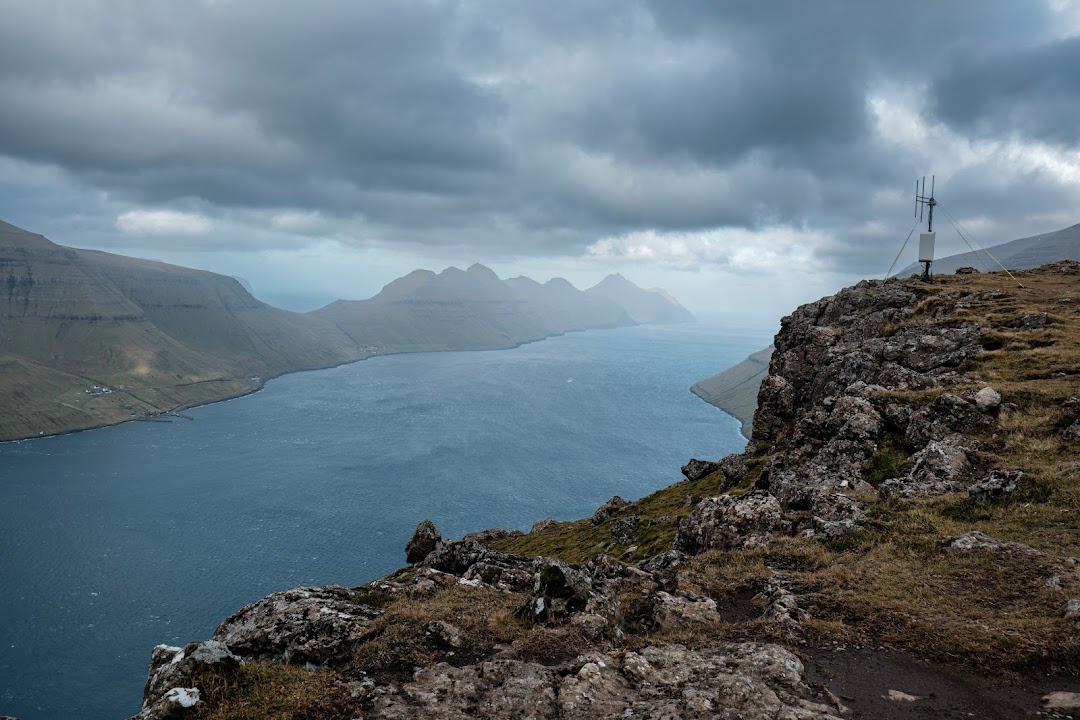
Drive to Klaksvik through the northern tunnel system. Use this as a flexible day: Klakkur viewpoint if conditions are good, Vidoy scenery if you want a quieter north-end drive, or Kalsoy only if ferry timing is realistic.
Kalsoy is often underestimated. The ferry is capacity-limited, weather can interrupt plans, and the Kallur Lighthouse hike should not be squeezed into a late, windy afternoon. If the ferry day looks messy, keep the car on the connected islands and enjoy Klaksvik, Kunoy or Vidareidi scenery instead.

Day 6: Open Weather Buffer and Return
Use the last day as a weather buffer. If Vagar was fogged in on arrival, return for Gasadalur or Tralanipa. If the north was clear but Torshavn was rainy, spend the morning in the capital before returning the car.
Do not plan a long cliff hike immediately before an outbound flight. Fog, sheep on roads, slow tunnels and rental return queues can all eat into the schedule.
Why Rent a Car Here
Public buses exist, but the Faroe Islands are strongest as a Road-trip because a car lets travelers:
- Start viewpoints during clear weather windows
- Link Vagar, Streymoy, Eysturoy and the Northern Islands without rebuilding the day around bus times
- Carry rain gear, spare layers and groceries
- Retreat quickly when fog or wind makes a hike unsafe
- Visit quieter village and fjord viewpoints promoted by newer local road-trip concepts
Choose a compact car. Bigger vehicles are less useful on one-lane village roads and tight parking areas.
Driving Notes and Tunnel Costs
The main roads are well maintained, but the driving style is different from mainland Europe. Expect one-lane tunnels, sheep near roads, sudden fog and frequent speed changes near villages.
Before leaving the rental desk, confirm:
- How toll tunnels are billed
- Whether an unlimited tunnel pass is available
- Insurance rules for gravel pullouts and wind-door damage
- Emergency phone number and roadside process
- Whether your group is comfortable with manual transmission
Rental companies and travel guides commonly list the major subsea tunnels as paid routes, with tourists typically billed through the rental company rather than stopping at a booth. Ask for the exact 2026 tunnel terms in writing because admin fees vary.
Best Season
May to September is the best window. June and September are especially good for a balance of daylight, fewer crowds and manageable prices. July and August bring the most services, but also higher lodging pressure and busier trailheads.
Winter is possible for experienced travelers, but this guide is not designed as a winter road-trip. Short daylight, wind and ferry disruption change the risk profile.
Local Customs and Practical Cautions
- Ask before photographing people, working farms or close views of private homes.
- Stay on marked hiking routes; much land is privately owned.
- Pay required hiking fees instead of looking for informal shortcuts.
- Do not fly drones near villages, birds, livestock or signed no-drone areas.
- Pull over only at safe lay-bys; never stop in tunnels or passing places for photos.
- Pack waterproof layers even when the forecast looks calm.
- Keep snacks in the car because rural cafes may be closed outside peak season.
Visa and Entry Notes
The Faroe Islands are not part of the EU or the Schengen Area. Do not assume a Schengen visa automatically covers entry. Visa-required travelers must apply specifically for the Faroe Islands through the Danish system, and some travelers may also need Schengen transit coverage when routing through Denmark or another Schengen airport.
Quality Check
Lead quality: High quality
Reason: the route is timely, map-friendly and suitable for LBS enrichment. It combines classic sights with practical dispersal logic, current access-fee awareness, rental/tunnel cost checks and strong road-trip value.
Sources checked:
- Condé Nast Traveler and AFAR coverage in 2025 on the Faroe Islands self-navigating road-trip concept
- Official Faroe Islands visa guidance and Danish visa guidance for Faroe Islands / Greenland
- Official Tralanipa pricing page for the Lake Above the Ocean hike
- Guide to Faroe Islands tunnel guide and rental-toll explanations
- Come North 2026 rental FAQ for current tunnel-pass examples
- Tourants Maps distance checks for Vagar Airport, Torshavn, Saksun, Gjogv and Klaksvik
- Unsplash image search for Faroe road-trip cover and body visuals


Travel Tips
No tips yet. Be the first to share!